With our LPIS API you get access to public agricultural administrative units, crop references, land-use references and parcel geometries through a single API end-point. Integrate the API with your web-app or model, to utilize the data in your solution.
Check out the live data showcase here: SHOWCASE
Features
Performance
High performance stack – Speed is key for a modern web experience. The LPIS API is build for a modern web-framework where all datasets and queries are continuously optimized to ensure the data you need is available when you need it – Optimizing performance and ensuring a fast scalable web-experience.
Consistency and stability
The days of broken WMS/WFS at national or regional end-points are over – The LPIS API ensures that you can always access the data you need through one single end-point. This ensures stability of your application and reduces maintenance since you don’t have to update custom scripts regularly.
Standardized cross-border data query
EU-wide standardization and harmonization of datasets with easy to work with GeoJSON formats makes it super easy to scale your application across different European countries. No more custom integrations of country/region specific GIS formats or projections.
Compliance
ICAS/LPIS is becoming THE source of ground truth not only for CAP payments, but also for EU wide carbon farming schemes and carbon taxes. If you want to future proof your solution or work with compliance solutions, this is the dataset to build on.
LPIS API Use cases
The LPIS API data product can be integrated with a wide variety of solutions. Below are some examples of solutions that integrate with the API.
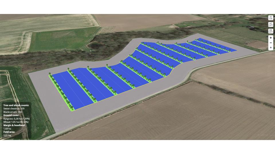
RegenWorks
The Agroforestry design Software RegenWorks integrates ready-made parcel geometries through the LPIS API.

Open Farm Carbon Tracker
The farm scale carbon assessment model Open Farm Carbon Tracker, integrates field specific crop references through the LPIS API for automated data entry.
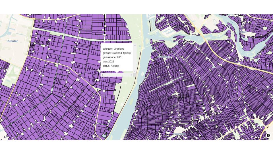
RegenMaps
RegenMaps is a web-viewer for EU-wide parcel data that makes it easy to browse agricultural parcel data.
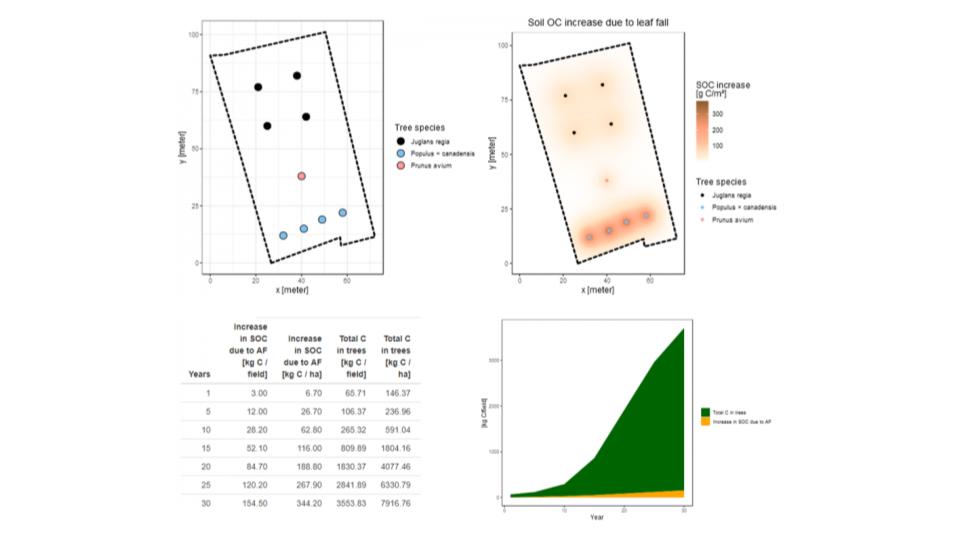
CARAT
CARAT field scale agroforestry GHG model integrates with LPIS API for automated EU-wide parcel geometry input.