A revolutionary agroforestry project development tool for farmers and agricultural service providers.
RegenWorks is a fast way to design agroforestry systems for a specific piece of land and enterprise. From initial land mapping and system design to financial analysis and implementation – RegenWorks is here to support your decisions. If you want to plan production systems that build resilience, increase profit and have a positive impact on the planet RegenWorks is the perfect tool for you.
Agroforestry Projects Made with RegenWorks
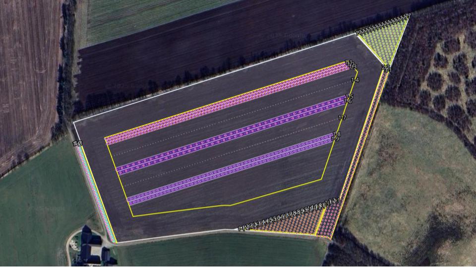
Diverse Alley Cropping System (Denmark) 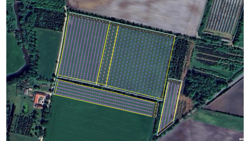
Grazed nut orchard layout (Denmark) 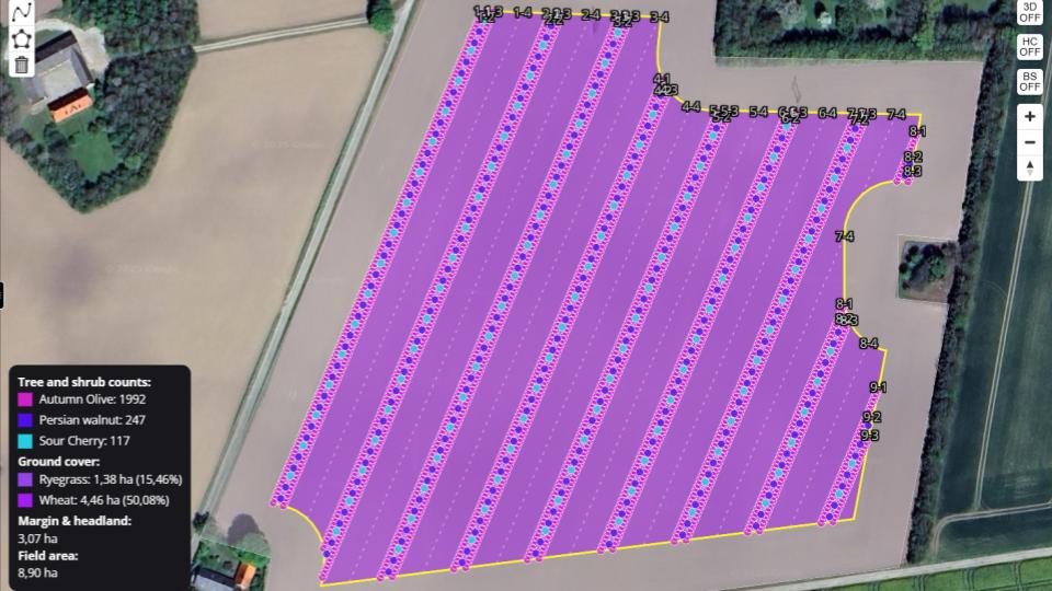
Alley cropping system with walnuts and cherry (United Kingdom). 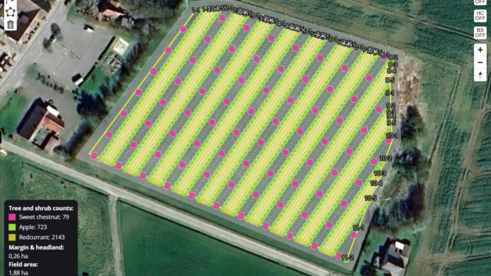
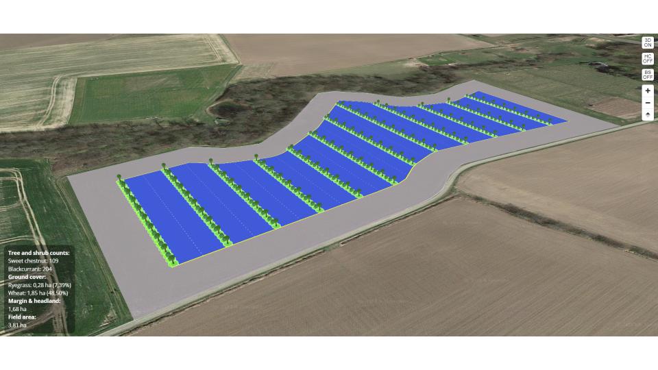
Multistory temperate agroforestry system with chestnuts and currants (Denmark). 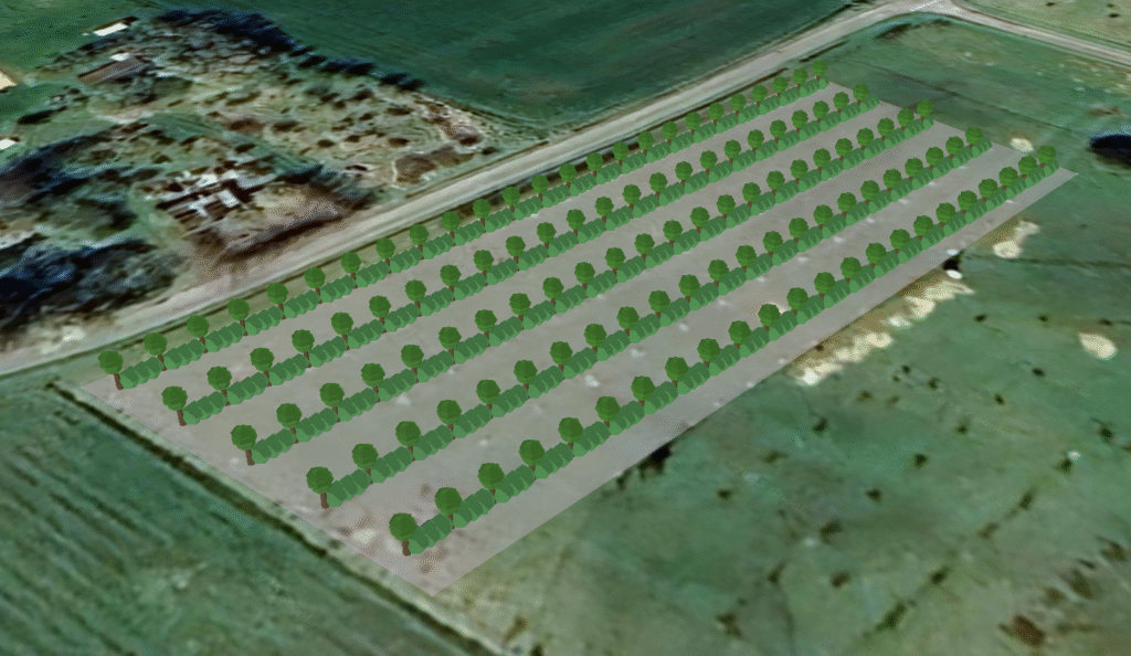
3D rendering – Diversified orchard (Denmark). 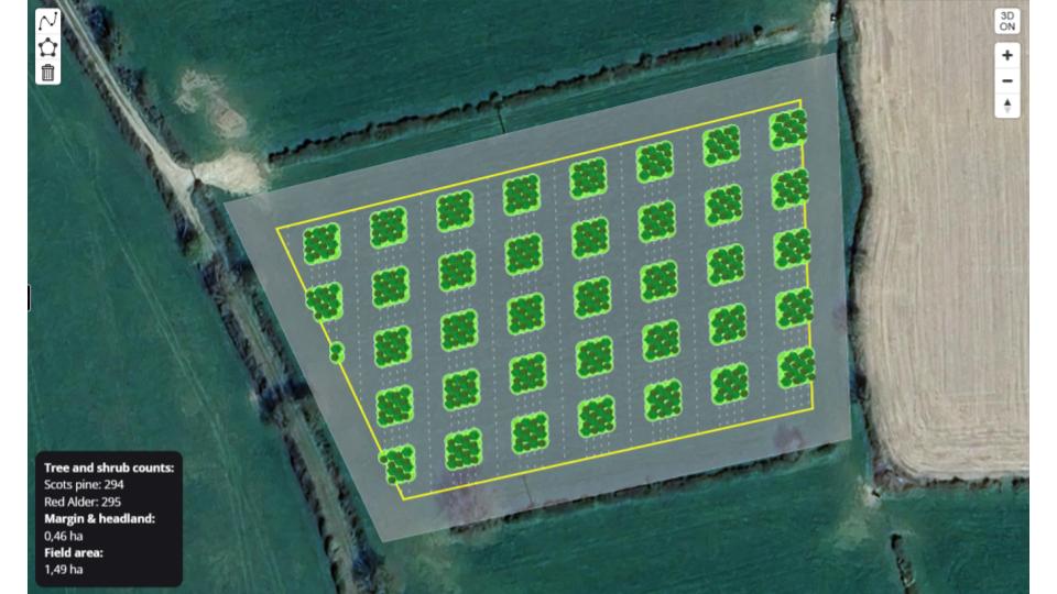
Silvopasture w. timber – Block design (Ireland)
RegenWorks Features
Farm planning
Keep on top of things and save time
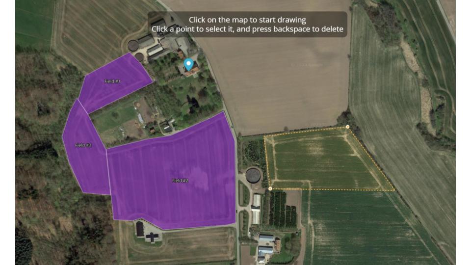
Every farm is unique. With RegenWorks it becomes easy and fast to do context-specific agroforestry designs and plans for individual pieces of land.
- Create individual fields.
- Define the current production system for each individual field.
- Use existing field parcels from national data registries such as LPIS data or upload existing farm plan geometries. .
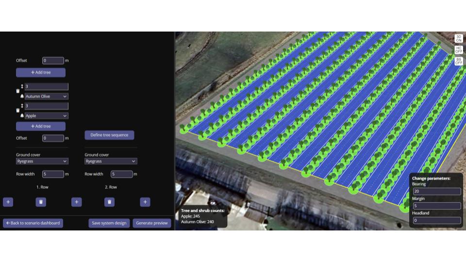
Agroforestry system design
Design agroforestry systems that fit your land. .
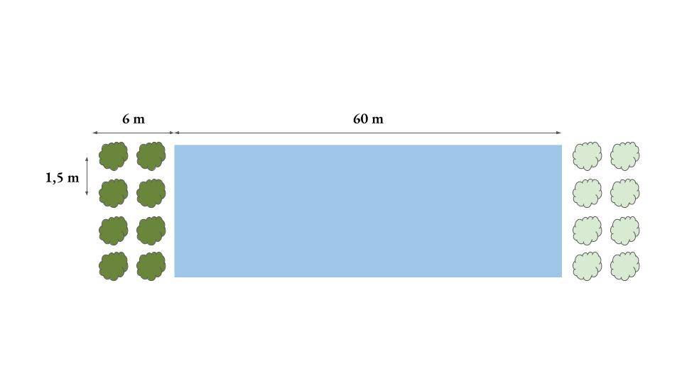
- Start designing quickly using agroforestry system presets.
- Define tree rows, species, cropping alleys and tree grass strips.
- Support for designs with alternating rows, complex row sequences, row offsets and more.
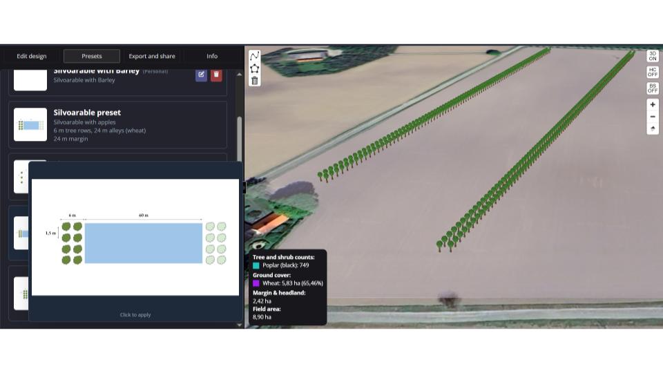
GIS-based agroforestry system layouts
Explore layout options for the agroforestry system on specific fields.
- Define and explore different layout parameters such as headland, row orientation and field margins for designs on specific fields.
- Estimate tree counts for analyzing system light distribution or for evaluating compliance with local agroforestry regulations
- Calculate required planting material and seeds for system establishment.
- Evaluate various parameters such as trees per ha and total area with a specific crop.

Agroforestry design documentation
Create technical work drawings and planting plans of agroforestry designs, so it’s easy to implement the system in the field.
- Generate planting plans as JPG or as online link.
- Includes color legend and numbered references for trees, tree strips and alleys.
- Export GIS file with coordinates for individual trees.
- Export tree strip or alley geometries.
Realistic 3D visualizations
Visualize your agroforestry system with proprietary realistic 3D renderings.
- Visualize individual agroforestry systems with specific crops and trees in 3D.
- Visualize the whole farm project.
- Experiment with different types of visualization filters to highlight specific aspects of the agroforestry system.
Share and collaborate
Agroforestry design is a collaborative discipline
There are several ways to engage with other farmers, colleagues and peer, to share and get feedback on a specific design.
- Share your project with farmers, advisors and other stakeholders to make sure everyone is properly involved in the design process and aligned with the final plan.
- Share specific agroforestry system designs with a unique link. You can see an example here.
Start planning now!
Create a user, choose a plan and get started planning your agroforestry systems.

